do geography / zwischenraumkarten
10 maps about the interspace
bridge and tunnel map
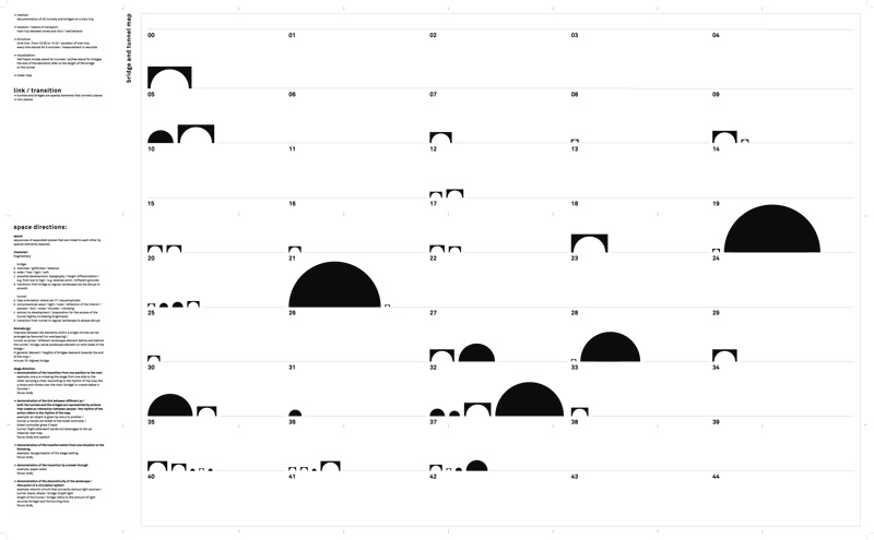
// method: documentation of all tunnels and bridges on a train trip
// location / means of transport: train trip between arosa and chur / switzerland
// structure: time line / from 12:05 to 12:42 / duration of train trip // every line stands for 5 minutes / measurement in seconds
// visualization: half black circles stand for tunnels / arches stand for bridges the size of the elements refer to the length of the bridge or the tunnel
// linear map
// content: link / transition
// tunnels and bridges are spatial elements that connect places // non-places
>>
<< back to overview
<< back