do geography / zwischenraumkarten
10 maps about the interspace
signage map
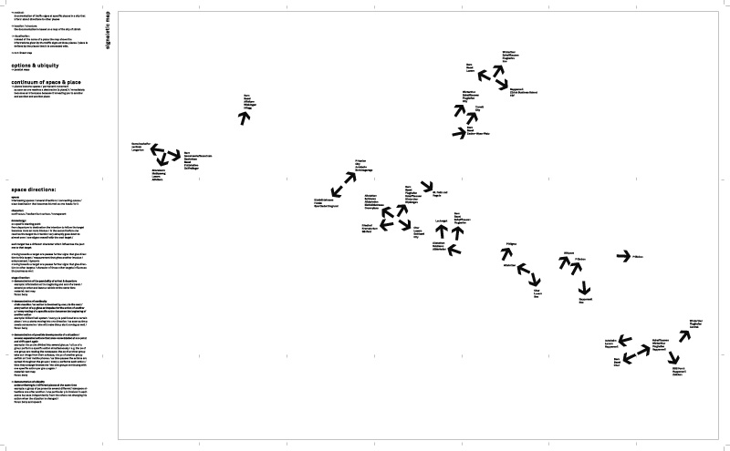
// method: documentation of traffic signs at specific places in a city that inform about directions to other places
// location / structure: the documentation is based on a map of the city of z³rich
// visualization: instead of the name of a place the map shows the informations given by the traffic signs at those places / place is defined by the places that it is connected with.
// non-linear map
// content:
options & ubiquity // parallel ways
continuum of space & place // places become spaces / permanent movement // as soon as one reaches a destination (a place) it immediately // becomes an interspace because it is leading you to another and another and another place
<< >>
<< back to overview
<< back