do geography / zwischenraumkarten
10 maps about the interspace
local time map map
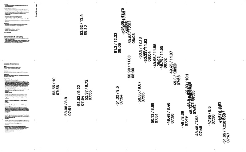
// method: documentation of places by geographical coordinations and local time differences
// location / means of transport: the places shown in the map represent specific cities that i passed regularly while travelling through germany by train / for me those cities originally are more connected to a certain time schedule, the one of the deutsche bundesbahn than to a spatial order
// calculation of the local time at those places: 1 degree of latitude = 4min time difference e.g. if you travel from berlin and hanover (246 km) within 15min (1056 km/h) you would reach hanover at the same time that you left berlin
// structure: the position of the coordinates refer to real geography, the basis of the documentation is a map of germany
// visualization: geographical coordinates + local time / latitude 11 corresponds to 08:00
// non-linear map
// content:
parallelism & ubiquity // every place has its local time / at 2 different places there are // always 2 different times / if time and place do not develop parallel but always with a time difference you can be at 2 different places at the same time // shifted unisono / fugue / assembly line / echo
<< >>
<< back to overview
<< back